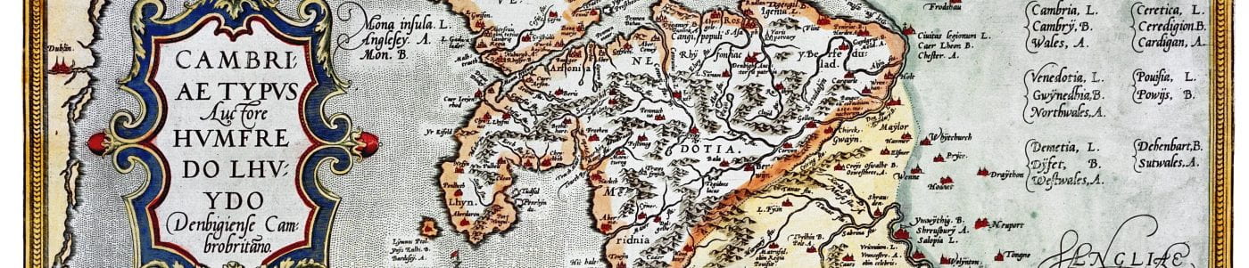
Humphrey Llwyd’s map of Wales, 1572
(by permission of the National Library of Wales)
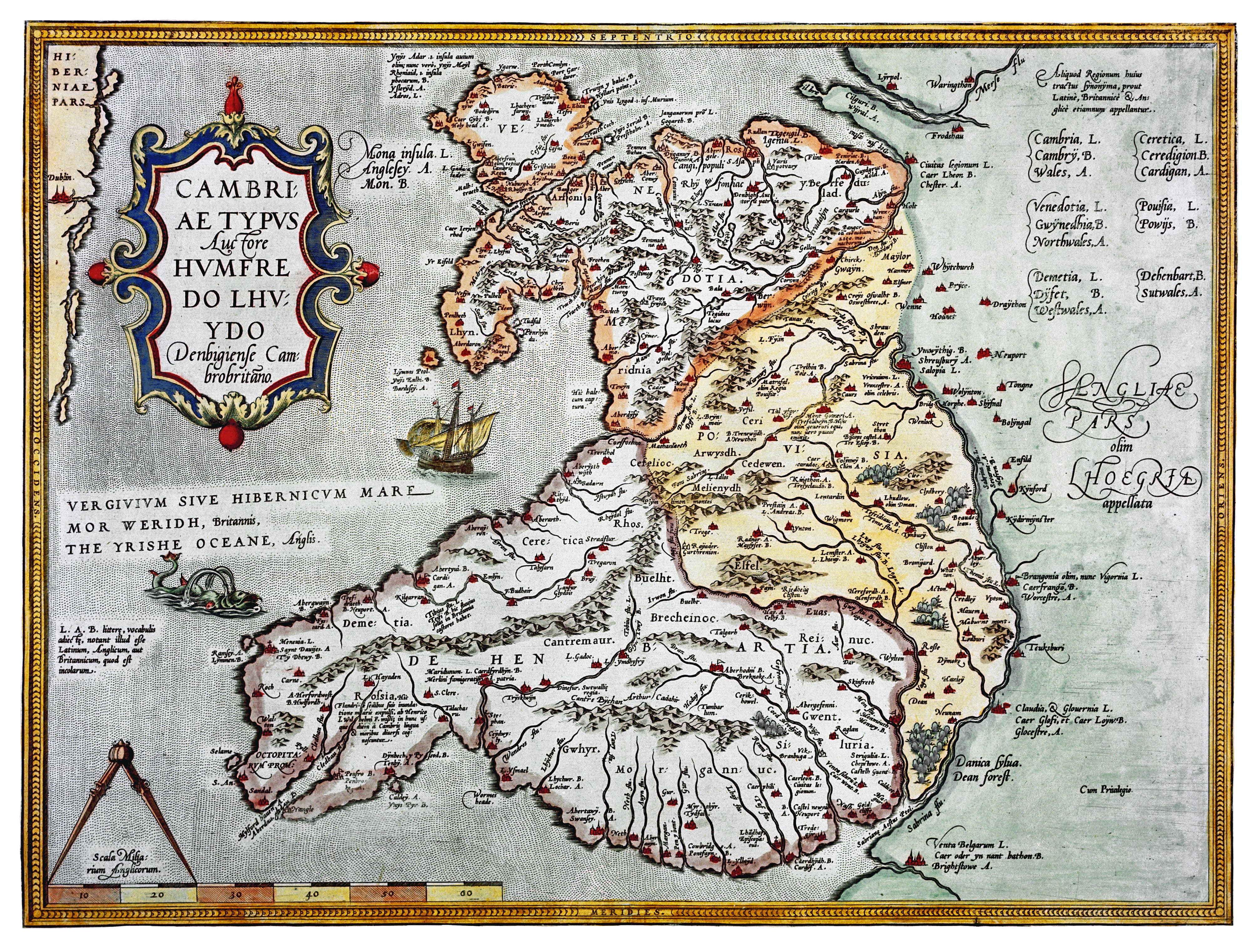
Cambriae typus, one of the earliest maps of Wales, was completed in 1568 by Oxford graduate, historian, author, cartographer, and practising physician, Humphrey Llwyd (1527–1568). He was described by English antiquarian Anthony Wood as ‘a person of great eloquence, an excellent rhetorician, and a sound philosopher’, as well as being a noted antiquary and a staunch supporter of Welsh language and culture.
Humphrey Llwyd began his career in the service of Henry Fitzalan, the twelfth Earl of Arundel. He took sole responsibility for the household’s vast library collection which provided him with access to a wealth of literary and historical material. Through his connection with the Arundel family, Llwyd later became a member of parliament for the constituencies of East Grinstead and Denbigh consecutively, and it was Denbigh, on the March of Wales, which became his home for much of his life.
Llwyd was the author of a number of works, including the Commentarioli Britannicae descriptionis fragmentum, published posthumously in 1572, a guide to travel and geography in Tudor Britain. It was translated into English by Thomas Twyne in 1573 under the title The Breviary of Britayne. His most significant work was his history of Wales, Cronica Walliae, completed in 1559 and eventually published as part of David Powel’s Historie of Cambria in 1584. Based partly on medieval Welsh chronicles, particularly Brut y Tywysogion (‘Chronicle of the Princes’), Llwyd’s history, the only work of his in English to have survived, remained an authoritative source until the nineteenth century.
On returning from a trip to Italy with Arundel in 1567, Llwyd was introduced to Belgian publisher and cartographer Abraham Ortelius, who requested Llwyd’s assistance in producing a map of Britain. Llwyd’s pioneering map of Wales, completed shortly before his death in 1568, was published four years later in a supplement to Ortelius’s Theatrum Orbis Terrarum – one of the first modern atlases.
In the letter which accompanied his manuscripts, Llwyd described the Welsh map as ‘not beautifully set forth in all poynctes, yet truly depeinted, so be that certeyn notes be observed.’ The map contained a number of inaccuracies, especially in its depiction of the coastline of Wales, and Llwyd’s map can be compared with the more accurate cartography of Christopher Saxton [link to Saxton map], who was a professional surveyor.
Cambriae typus remains a significant work because it is the first printed map which shows Wales as a region separate from England. It also portrays Wales extending across the modern political border into what is now England, suggesting the historical reality of the March in the sixteenth century.
References
Jones, R. Brinley, ‘Llwyd, Humphrey (1527–1568)’, Oxford Dictionary of National Biography (Oxford: Oxford University Press, 2004). <http://www.oxforddnb.com/view/article/16867>
Llwyd, Humphrey, Cronica Walliae, ed. by Ieuan M. Williams (Cardiff: University of Wales Press, 2002).
North, F. J., Humphrey Lhuyd’s Maps of England and Wales (Cardiff: National Museum of Wales, 1937).
North, F. J., ‘Place Names and Old Maps’, Wales, 5.8/9 (Dec 1945), 33–41.
O’Rourke, Jason, ‘English and Latin Texts in Welsh Contexts: Reflections of a Multilingual Society in National Library of Wales MS Peniarth 12’, The Yearbook of English Studies, 33 (2003), 53–63.
Schwyzer, Philip (ed.), Humphrey Llwyd, The Breviary of Britain, with Selections from The History of Cambria (London: Modern Humanities Research Association, 2011).
Wood, Anthony, An Exact History of All the Writers and Bishops who have had their Education in the University of Oxford, vol. 1 (London, 1813).