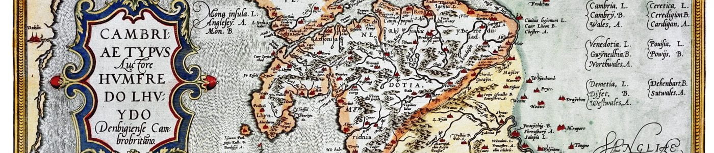
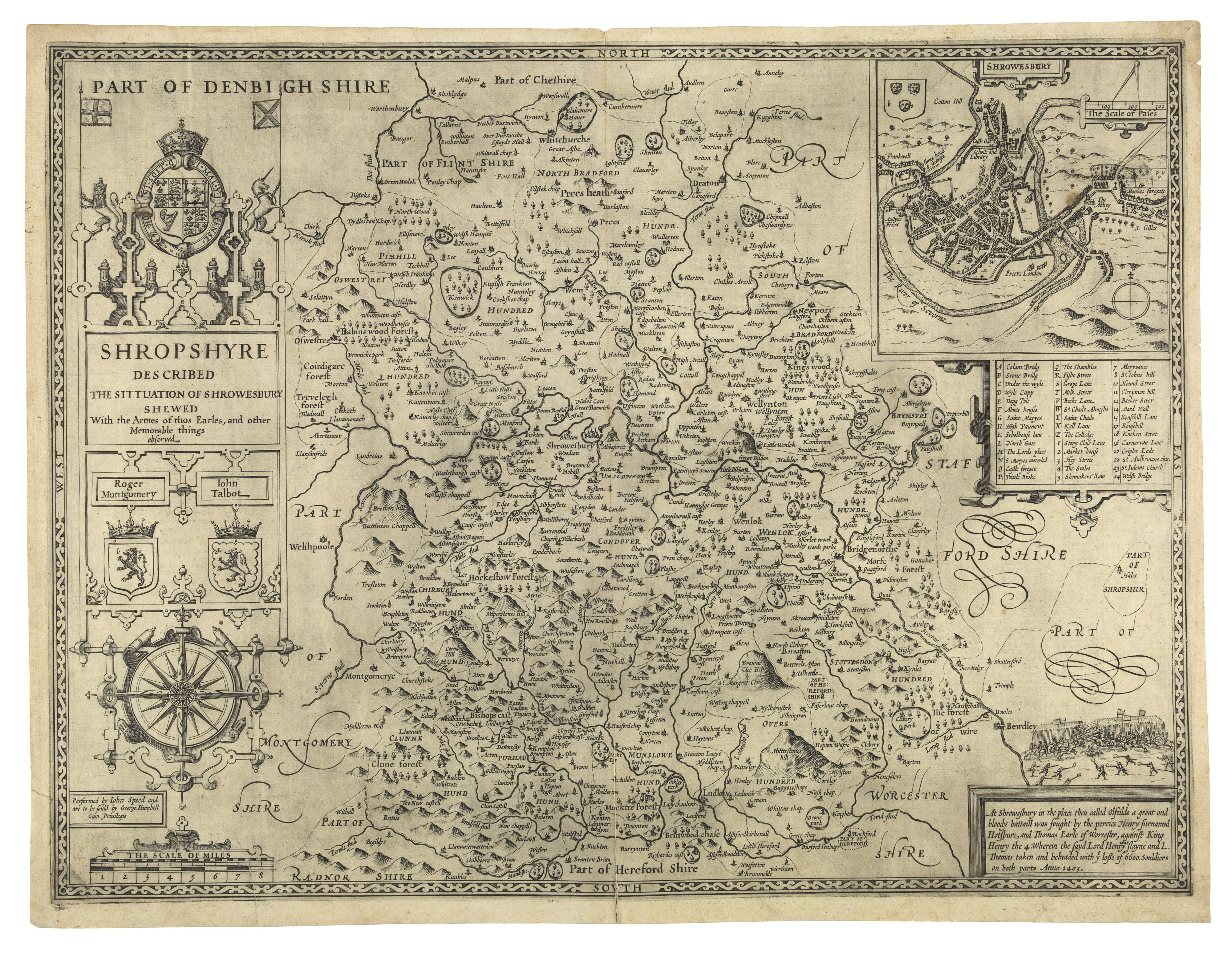
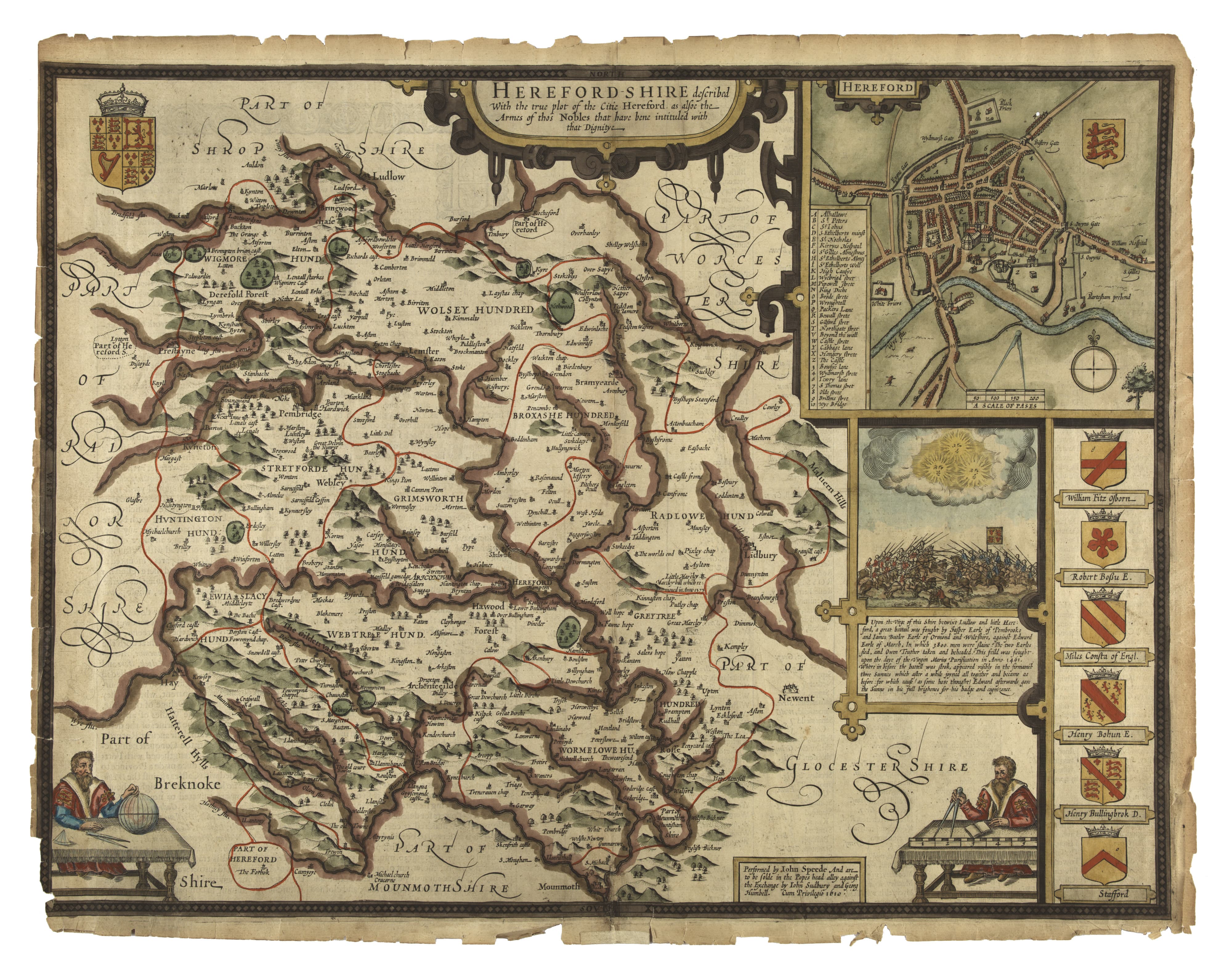
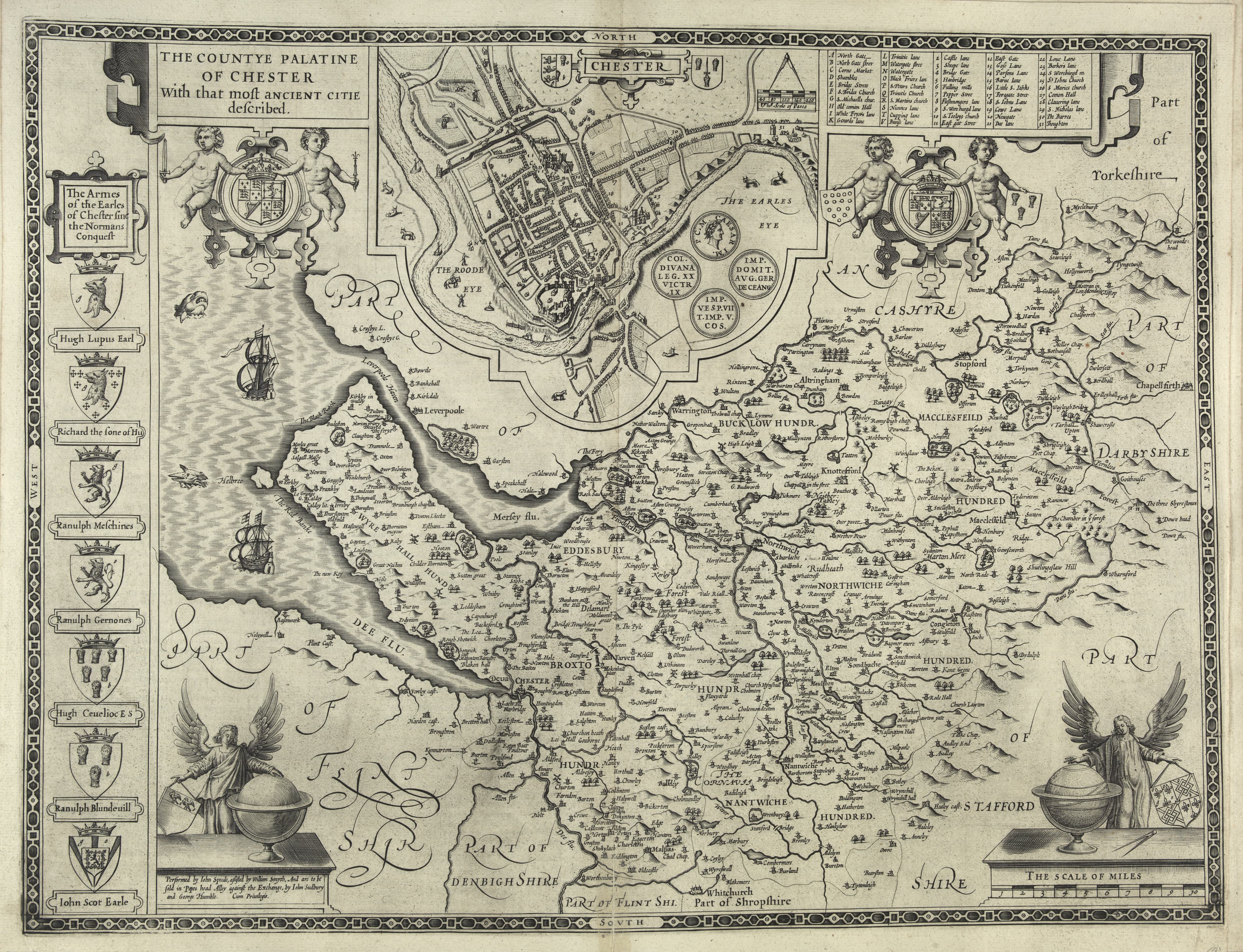
John Speed (1551/2–1629), maps of the Marcher counties
(by permission of the National Library of Wales)
John Speed’s county maps of England and Wales, published in his Theatre of the Empire of Great Britaine in 1611–12, were the first maps of individual counties in Britain. The maps included here show the Marcher counties on both sides of the modern political border between Wales and England.
Shropshire
Herefordshire
Gloucestershire

Cheshire
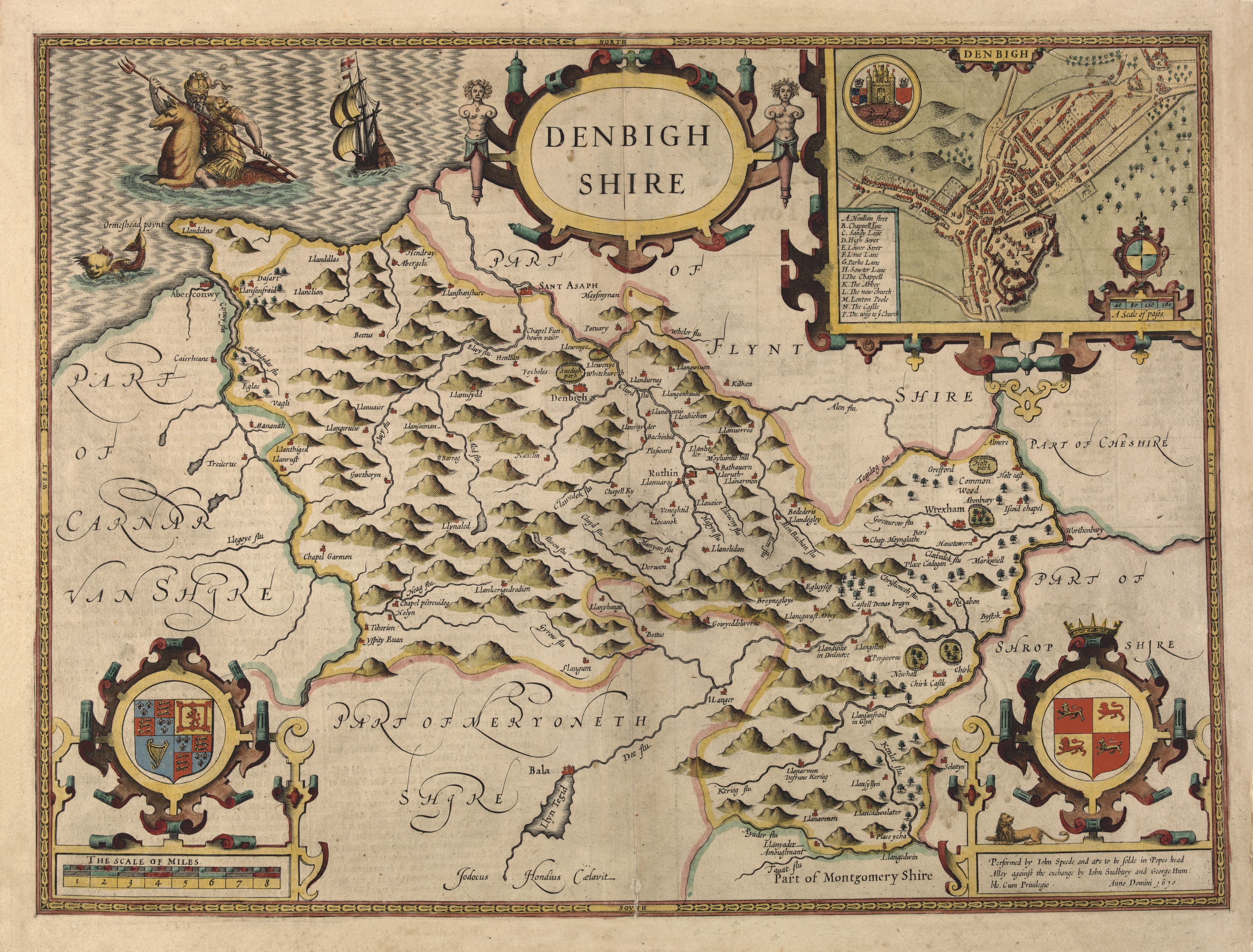
Denbighshire
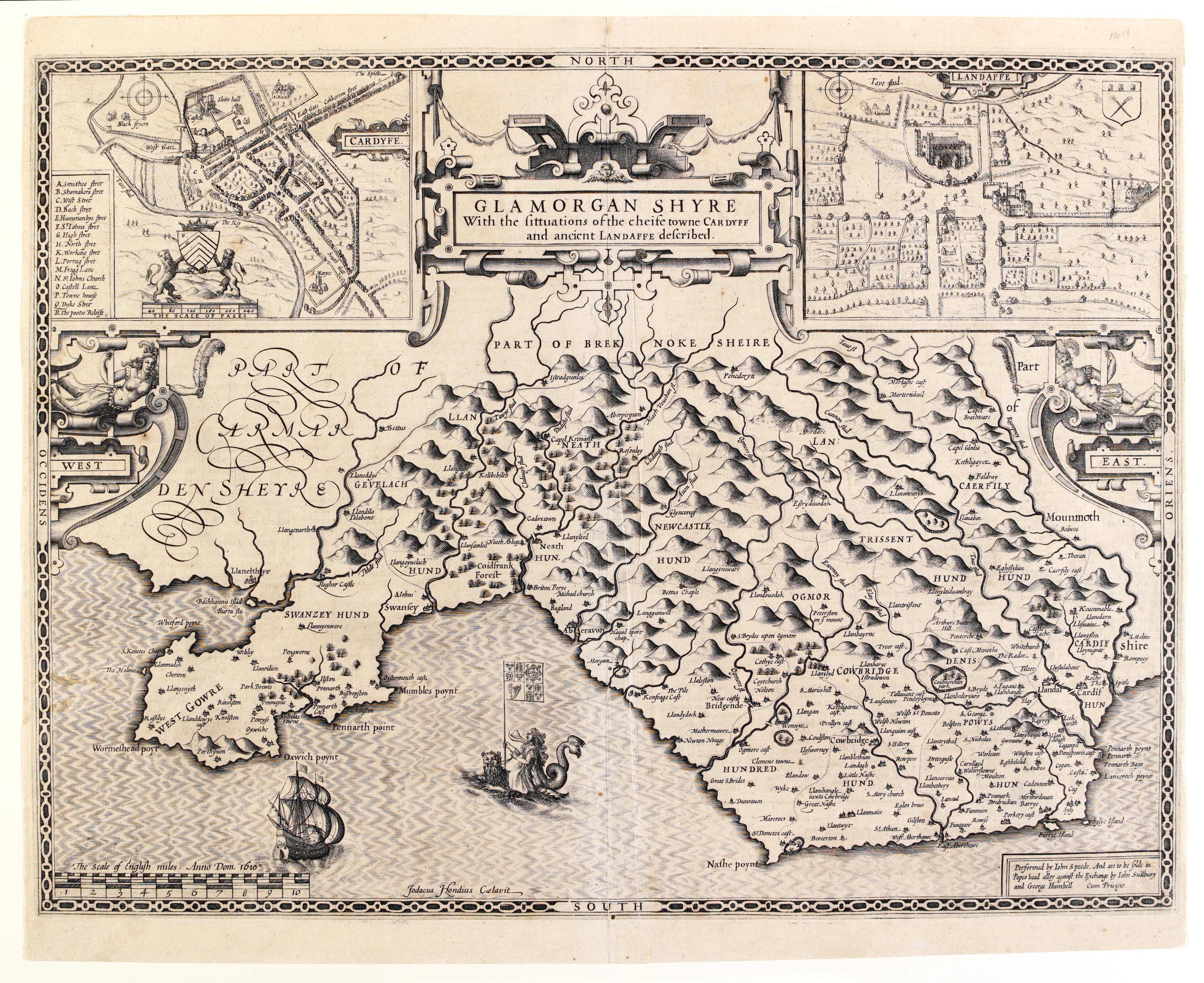
Glamorganshire
Monmouth

Montgomery

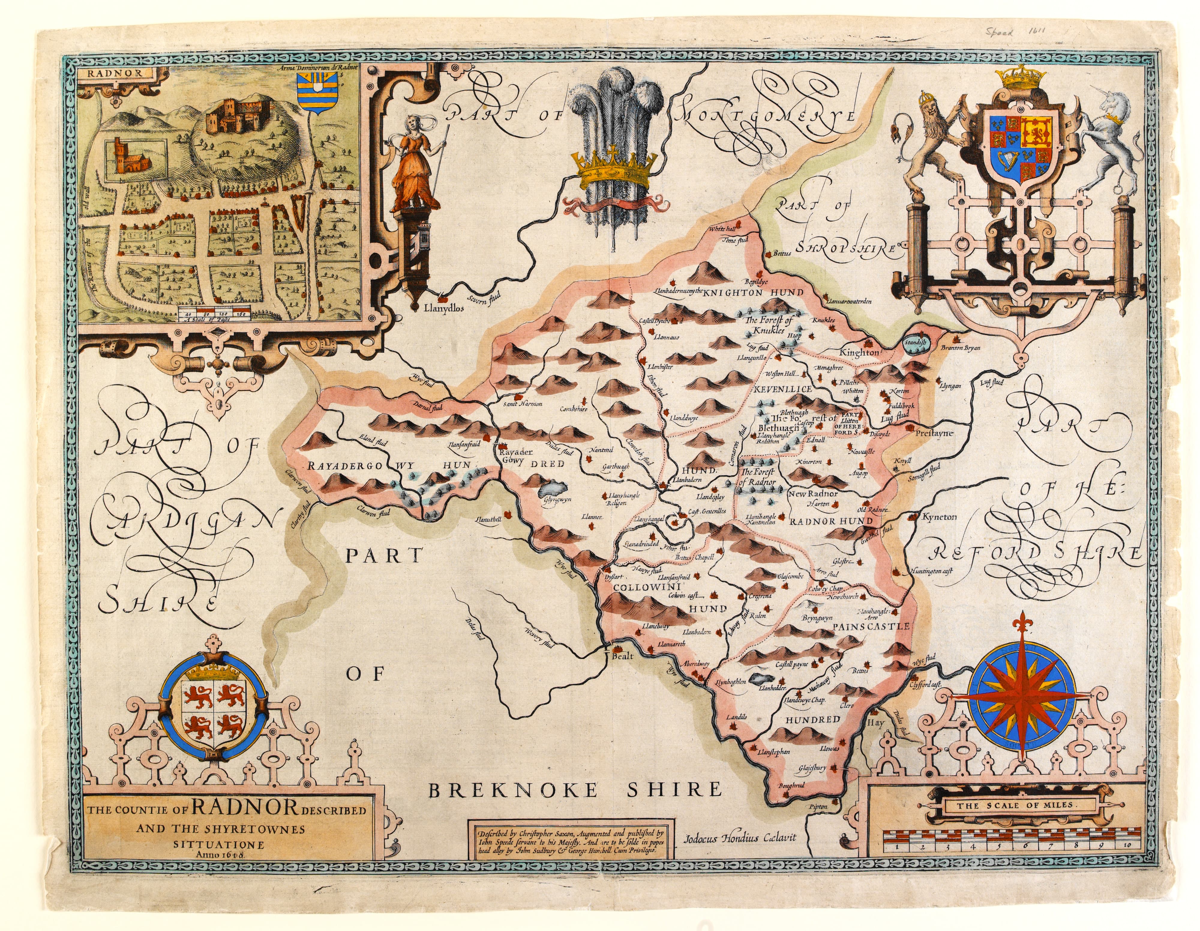
Radnorshire
John Speed was a London tailor and property-owner with interests in theology, history, and cartography. Encouraged by William Camden, Robert Cotton, and other London antiquarians, Speed produced (with the help of professional engravers) his county maps, using the model of Abraham Ortelius’s Theatrum orbis terrarum which had first appeared in English in 1606.
Speed’s volume of county maps was accompanied by his written history of Britain (Historie of Great Britaine, 1611), and both maps and history were the product of intensive research using manuscripts and printed works of contemporary antiquarians and cartographers, including Christopher Saxton. [link to Saxton page] Later in his life, Speed also designed the maps for a world atlas, A Prospect of the Most Famous Parts of the World (1627), which circulated widely throughout Europe.
Speed’s county maps are particularly notable for the town plans which appear on a number of the maps, many of them the first street maps of those towns. Town plans of Shrewsbury (Shropshire), Hereford (Herefordshire), Gloucester (Gloucestershire), Chester (Cheshire), Denbigh (Denbighshire), Cardiff (Glamorganshire), Monmouth, Montgomery (Montgomeryshire), and Radnor (Radnorshire) appear on the maps shown here.
Speed’s original maps were in colour, though some are shown here in black and white.
References
Bendall, Sarah, ‘Draft Town Maps for John Speed’s Theatre of the Empire of Great Britaine’, Imago Mundi, 54 (2002), 30–45.
Bendall, Sarah, ‘Speed, John (1551/2–1629)’, Oxford Dictionary of National Biography (Oxford: Oxford University Press, 2004).
Nicolson, Nigel (ed.), The Counties of Britain: A Tudor Atlas by John Speed (London: Thames and Hudson, 1989).
Skelton, R. A. (ed.), A Prospect of the Most Famous Parts of the World, by John Speed (Amsterdam: Theatrum Orbis Terrarum, 1966).