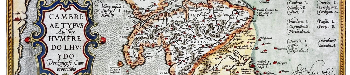
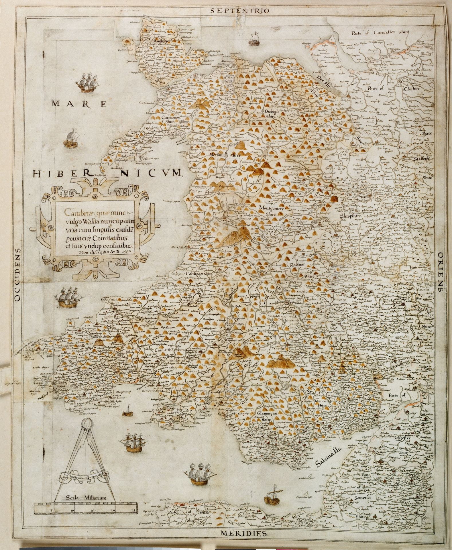
Christopher Saxton’s map of Wales, 1580
(by permission of the National Library of Wales)
Christopher Saxton is thought to have been born sometime between 1542 and 1544 to a Yorkshire yeoman family of clothiers and farmers. Apprenticed to John Rudd, vicar of Dewsbury, as a surveyor and cartographic draughtsman, he travelled alongside Rudd on map-making expeditions in England.
Saxton was later commissioned by Thomas Seckford, Master of Requests to Elizabeth I, to complete a topographical survey of England and Wales in order to aid state administration. The series of 34 coloured maps of the counties of England and Wales was produced between 1574 and 1579 and was published as the Atlas of England and Wales. Although it is assumed that Saxton would have drawn upon existing material, evidence shows that personal field observation played a major part in completion of the survey. Using letters of warranty endorsed by Elizabeth I, he was able to enlist the assistance of local residents in identifying and naming topographical features.
Saxton’s atlas, which included a full-page map of England, known as Anglia, set new standards in British cartography and formed the basis of subsequent county maps up until the eighteenth century. A copy of Anglia survives in the British Library
In 1583, Saxton produced a twenty-sheet wall map, again encompassing England and Wales, entitled Britannia. Later surviving versions of the Britannia wall maps ensured that Saxton’s work continued to be cited for the next two hundred years, not least by eighteenth-century antiquary, Richard Gough, maker of the Gough Map, and nineteenth-century topographical writer Rev. John Evans.
Saxton’s 1580 map of Wales was purchased at Sotheby’s in 1986 by the National Library of Wales in Aberystwyth. It is considered to be Saxton’s proof-map for the Britannia wall map with which it shares a number of features and decorative qualities. The map itself measures 23” (58.4 cm) x 20” (50.8 cm) and its format suggests Saxton planned to produce a separate map of Wales, although this idea was never fulfilled.
Saxton’s 1580 map is considered to be of great importance, providing useful evidence for the study of early cartography and the history of map-making relating to Wales. It is the earliest surviving map of Wales which gives accurate portrayals of features of the Welsh coastline, including the Llŷn and Gower peninsulas.
References
Bower, David I., ‘Saxton’s Maps of England and Wales: The Accuracy of Anglia and Britannia and their Relationship to Each Other and to the County Maps’, Imago Mundi:The International Journal for the History of Cartography, 63.2 (2011), 180–200.
Fletcher, David, ‘Saxton, Christopher (1542×4–1610/11)’, Oxford Dictionary of National Biography (Oxford: Oxford University Press, 2004). http://www.oxforddnb.com/view/article/24760
Jones, Ieuan E., ‘Montgomeryshire on Old Maps’ Montgomeryshire Collections, 75 (1987), 9–28.
Owen, D. Huw and Julian J.W. Thomas, ‘Saxton’s Proof Map of Wales, 1580: Acquisition and Conservation;, National Library of Wales Journal, 25.1 (Summer 1987), 124–130.